That’s what Wikipedia says. What I say is: Toronto’s streetcar system is great for railway enthusiasts like me, but it is ridiculous and terrible for daily commuters –in the latter it is comparable to Toronto’s bus system, Toronto’s subway system and Toronto’s highways. Transit in Toronto is a tragedy, as newspaper articles, radio podcasts and fellow students tell almost every day. Whenever I see the hundreds of people waiting for a bus in front the university buildings, I’m happy to live on campus…
Instead of finally building modern light rail transit lines, which are part of a plan called “Transit City”, Major Rob Ford (“these damn streetcars”) announced the cancellation of Transit City on the day that he took office in 2010. The enlightened rest of the world has successfully arrived in the 21st century, but Rob Ford is still of the opinion that streets should only belong to cars and trucks…
According to Antonio Gómez-Palacio, who gave a speech at the Suburban Revolution conference (see a part of his speech here, this guy is awesome), a six-lane road has a capacity of 5,000 people per hour. A two-track light rail has a capacity of 20,000 people per hour. So you just have to dedicate one of three lanes per direction to a modern streetcar, and a lot of people will reach their office, home, university, whatever much faster.
So far most of Toronto’s inner city streetcars are stuck in traffic, with no dedicated rights-of-way. That makes going by tram a very time-intensive pleasure in this great city. It is horrible to use a tram if you are in a hurry, but it is a great way to explore the different neighbourhoods of the city without having to walk all day. So did Laura and me last Sunday, the next to last day my much too expensive monthly TTC pass was valid. The trams run through Italian, Indian, Polish, Chinese and Ukrainian neighbourhoods; through the heart of the financial district; along the waterfront and to the beaches; through so called “streetcar suburbs” and to High Park. Three lines are currently under construction, but we’ve seen a lot of interesting things along and near some of the other routes:
High Park…

…with its Zoo, …

…colourful trees…

…and colourful buildings, …

…the globe on Kensington Market…

…and the church at Jarvis Street, …

…East Chinatown Gate…

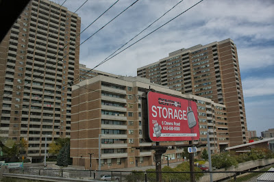
…and working class storages, …

...a beach on Lake Ontario, …

…and nice cafés next to Spadina Avenue, …


…where we finally finished our streetcar day.

Markus, das Chinatown Gate und die Spadina Ave wecken Erinnerungen. Wir sollten demnächst wieder mal eine Reunion der Geografie-Exkursion organisieren.. spielst du Gastegber? ;-)
AntwortenLöschenSollten wir auf jeden Fall machen! Ich spiele Gastgeber, ihr dürft gerne alle nach Toronto kommen ;)
AntwortenLöschen